
Blog
This blog will provide informal updates on the HiTech AlkCarb project, written by different researchers highlighting fieldwork, lab studies, conferences and Expert Council meetings. Keep track by following our Twitter account (@HiTech_AlkCarb) and sign up to our monthly newsletter.
Posts
- Technology Metals MOOC second run, May 2020
- HiTech AlkCarb – Policy Brief, 22 March 2020
- Technology Metals MOOC launches, 13 January 2020
- HiTech AlkCarb workshops in London, 26–27, November 2019
- The 16th South African Geophysical Association (SAGA) Biennial Conference, Durban, October 2019
- Kaiserstuhl Volcanic Complex Northern extension, October 2019
- Presentation of research results and the 3D-model of the Kaiserstuhl volcano at the Open Day at the Naturzentrum Kaiserstuhl, October 2019
- HiTech AlkCarb at at the Geological Society of Namibia 50th anniversary conference, Windhoek, September 2019
- HiTech AlkCarb at SGA2019, Glasgow, August 2019
- HiTech AlkCarb at Goldschmidt2019, Barcelona, August 2019
- HiTech AlkCarb Leapfrog Modelling Workshop, Monchique, August 2019
- Catalogue of Alkaline Rocks and Carbonatites of the world, August 2019
- Constructing a digital, dynamic 3D model of the subsurface of the Kaiserstuhl mineralised district, May 2019
- Workshop in Tübingen, November 2018
- Geophysics, mineralisation models and best environmental practice: fieldwork in Namibia, April 2018
- Advancing Geomodels for HiTech metal deposits: Expert Council 4, Moravian Karst, Czech Republic, March 2018
- HiTech AlkCarb Open Day and fieldtrip at Kaiserstuhl, October 2017
- Second HiTech AlkCarb field visit to Mongolia, September 2017
- HiTech AlkCarb fieldtrip to Greenland, June 2017
- HiTech AlkCarb work in the laboratory
- REE deposit road trip, Northern Gobi Rift Zone, Mongolia
- Fieldwork in the NW Scottish Highlands and Expert Council Three in Edinburgh
- Airborne geophysical survey of the Kaiserstuhl complex and project presentation by

- Expert Council Two – Malawi – Fenite and Geophysics as Exploration Tools
- Greenland fieldwork July–August 2016
- HiTech AlkCarb – Expert Council One – Italy
- Ground geophysics under way at Kaiserstuhl
- First meeting with the mayor of the Vogtsburg Gemeinde and heads of councils to introduce the anticipated scientific programme at the Kaiserstuhl alkaline-carbonatite volcano, Germany
- HiTech AlkCarb kick–off meeting 22–23 Feb 2016 | Mission for Improved Mineral Exploration Underway!
Technology Metals MOOC second run, May 2020
Our HiTech AlkCarb supported FutureLearn massive open online course, ‘Technology Metals for a Green Future’, is now open again for a second run. Visit the course website to find out more or to pass on to friends and family. You can read more about the course in an interview with Kate Smith and Frances Wall by the Critical Mineral Association.
Moving from fossil fuels to renewable energy and low carbon technology means moving to an 'age of metals'. We will need to mine more than ever before to build wind turbines, solar panels, and electric vehicles. This course takes a look at the specialist 'Technology metals' required to do this. It covers rare earths, tantalum, niobium, tin, tungsten, lithium etc – specialist metals essential in low carbon technologies and also in digital technologies such as smartphones, data centres, medical equipment. We discuss definitions, terms and uses in week one, geology in week two, mining and processing in week three and responsible sourcing and circular economy in week four. Many of the examples are from the HiTech AlkCarb project.
The course is free. It runs for four weeks, and can take about 4 hours a week to do all the activities, but it is also easy to dip into when you like in this period. It is all designed to be accessible to non–specialists so is nice and easy going.
Frances Wall, Kate Smith
HiTech AlkCarb – Policy Brief, 22 March 2020

A policy paper has been produced to summarise the learning points from the HiTech AlkCarb project experience of withdrawing from plans for a research drill hole at Kaiserstuhl, Germany. A geothermal project near to the Kaiserstuhl natural laboratory had caused severe damage to buildings in the historic town of Staufen, and a second geothermal project near Basel had caused small earthquakes. These negative experiences of drilling have caused the local politicians to withdraw the ‘social licence’ (social licence is the term for public acceptance and support for a project) from drilling projects, including ours. No distinction between geothermal and minerals was made. Once this social licence is lost it is difficult to regain and this adversely affected our plans to drill. Much consideration is being given to social licence to operate for new exploration and mining projects in Europe at the moment. It is important to include other subsurface projects, especially geothermal energy in consideration of social licence for minerals extraction.
Moving from fossil fuels to renewable energy and low carbon technology means moving to an 'age of metals'. We will need to mine more than ever before to build wind turbines, solar panels, and electric vehicles. This course takes a look at the specialist 'Technology metals' required to do this. It covers rare earths, tantalum, niobium, tin, tungsten, lithium etc – specialist metals essential in low carbon technologies and also in digital technologies such as smartphones, data centres, medical equipment. We discuss definitions, terms and uses in week one, geology in week two, mining and processing in week three and responsible sourcing and circular economy in week four. Many of the examples are from the HiTech AlkCarb project.
The course is free. It runs for four weeks, and can take about 4 hours a week to do all the activities, but it is also easy to dip into when you like in this period. It is all designed to be accessible to non–specialists so is nice and easy going.
Technology Metals MOOC launches 13 January 2020

The new Technology Metals for a Green Future MOOC (massive open online course) written by HiTech AlkCarb, with contributions from SoS RARE, launches on Monday 13 January.
Moving from fossil fuels to renewable energy and low carbon technology means moving to an 'age of metals'. We will need to mine more than ever before to build wind turbines, solar panels, and electric vehicles. This course takes a look at the specialist 'Technology metals' required to do this. It covers rare earths, tantalum, niobium, tin, tungsten, lithium etc – specialist metals essential in low carbon technologies and also in digital technologies such as smartphones, data centres, medical equipment. We discuss definitions, terms and uses in week one, geology in week two, mining and processing in week three and responsible sourcing and circular economy in week four. Many of the examples are from the HiTech AlkCarb project.
The course is free. It runs for four weeks, and can take about 4 hours a week to do all the activities, but it is also easy to dip into when you like in this period and watch some of the videos. It is all designed to be accessible to non–specialists so it is nice and easy going.
Here is the link if you are interested to find out more or would like to pass on to friends, e.g. in industry, schools, or other universities: https://www.futurelearn.com/courses/technology-metals-for-a-green-future
The course is also available on eLearnAfrica if you have contacts in universities, companies or senior schools in African countries: https://www.elearnafrica.com/c-united-kingdom/university-of-exeter/technology-metals-for-a-green-future-37012
Frances Wall, Kate Smith
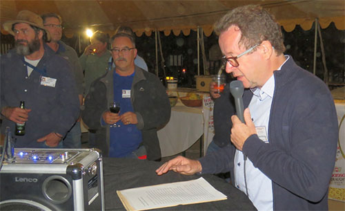
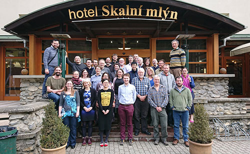
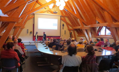
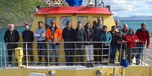
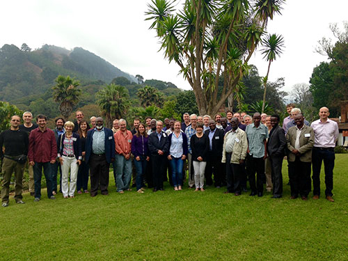
HiTech AlkCarb workshops in London, 26–27 November 2019
The HiTech AlkCarb project and sister project [1]SoS RARE are hosting a final dissemination workshop to celebrate 4.5 years of critical raw materials research, in London on 26th and 27th November. These days will discuss the outputs of the two projects, and their relevance to critical raw material research in Europe and around the world, with a view to future needs for scientific research, exploration, manufacturing industries and public policy. We look forward to hosting these meetings with international participants from around the world. Please see the meeting programmes and research talk summaries.
Day 1 (26th November at the Natural History Museum) will be a workshop to focus on the scientific advances from our projects and future challenges that we can work on as a scientific community, and will involve a day of keynote and contributed scientific presentations and discussions. Presentations will include results from HiTech AlkCarb and SoS RARE, as well as scientific contributions from researchers across the broader community.
Day 2 (27th November at the Royal Society) is aimed at a broad audience with interest in a green future, environmentally sustainable exploration and mining and hi-tech manufacturing. During the day we will discuss the big picture of our research and the need for critical raw materials, and we will highlight the key results of our work over the last few years and consider a vision for the future. In the evening we will hold a drinks reception to celebrate the past 4.5 years of work and launch some of our 3d project models.
We are fully booked for the day time sessions, but if you’d like to join us you can still register for the late afternoon session and reception at the Royal Society on 27th November (https://www.surveymonkey.co.uk/r/57MZZZJ), or you can join us for a live streamed video of project outcome presentations on the morning of 27th November (look out for the YouTube link coming soon on our social media channels).
This meeting has been organised by Emma Humphreys-Williams of the Natural History Museum, Pete Siegfried of GeoAfrica and Frances Wall and Kate Smith of Camborne School of Mines, University of Exeter, with the support of the HiTech AlkCarb and SoS RARE project teams.
The 16th South African Geophysical Association (SAGA) Biennial Conference, Durban, October 2019
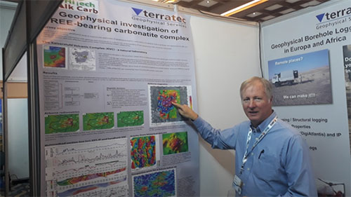
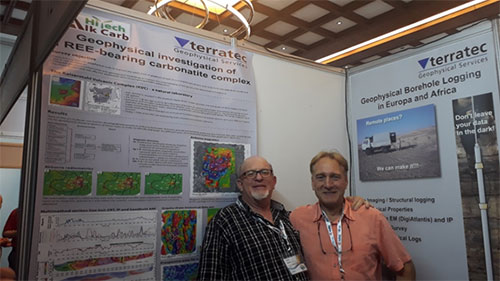
The 16th SAGA Biennial Conference and Exhibition was held in Durban, South Africa in October 2019. HiTech AlkCarb partner terratec Geophysical Services Namibia had a booth at the conference. The booth display included a poster showing work undertaken by terratec Geophysical Services over the Kaiserstuhl Carbonatite, as part of the HiTechAlkCarb project. A number of visitors were interested in the display, including Dan Hollis from SISPROBE who is a partner in the Horizon 2020 - Pacific project. SISPROBE and the University of Grenoble Alpes are collaborating with our project and will be collecting passive seismics data at the Kaiserstuhl during November 2019.
Greg Symons October 2019
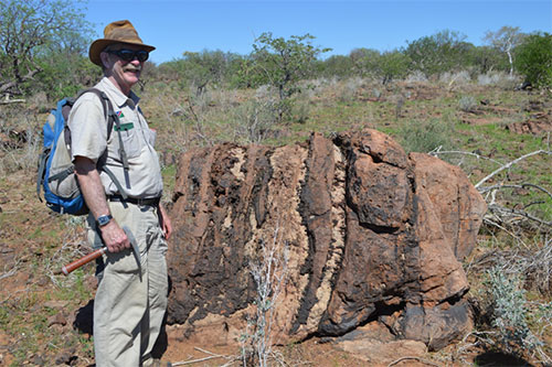
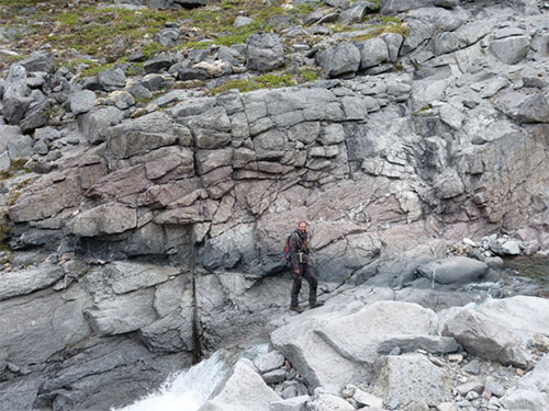
Kaiserstuhl Volcanic Complex Northern extension

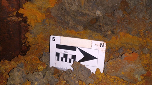
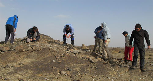
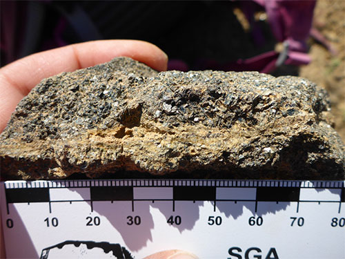
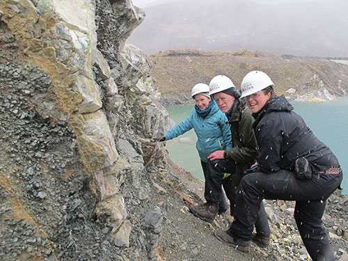
During the work on the Kaiserstuhl 3D model, and triggered by mineral systems research by Graham Banks as part of HiTech AlkCarb, a set of historically known magnetic anomalies approx. 15 km north of Kaiserstuhl became of interest for the project. These anomalies are situated on a major west-dipping boundary fault (named the Tuniberg fault in the Kaiserstuhl area). In April 2019 the northernmost magnetic anomaly of this zone was confirmed and relocated by doing a drone based magnetic survey, showing inverse magnetisation (similar to the older volcanic flows in the Kaiserstuhl).
The two anomalies situtated north and south of the town of Herbolzheim have a north-south extension of approx. 2 km and a E-W extension of about 400m. The northern anomaly is situated just west of an historic underground iron ore mine. Contact was made with the mine owner Zweckverband Abfallbe-handlung Kahlenberg (ZAK) and historical data (maps and sections) were made available. These documents indicate underground outcrops of tuff pipes intruded into the Jurassic rocks.
During an underground visit of the mine, the tuff was found and sampled by Andres Sawallisch and Klaus Brauch (terratec). The tuff contains a mixture of magmatic and sedimentary clasts in a clay matrix (very sticky to walk on!) A 25 kg sample has ben handed over to the University of Tübingen during the open day at Kaiserstuhl for further investigation.
We would like to thank the managing director at ZAK Mr. Georg Gibis, and the responsible engineer Mr. Thal, for their great support in making this sampling happen.
Klaus Brauch October 2019

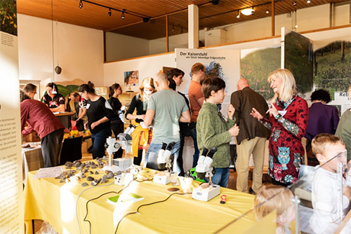
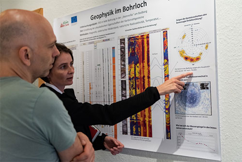
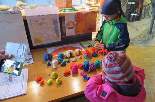
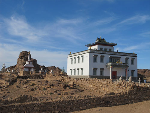
Presentation of research results and the 3D-model of the Kaiserstuhl volcano at the Open Day at the Naturzentrum Kaiserstuhl

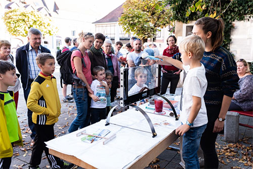
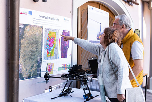
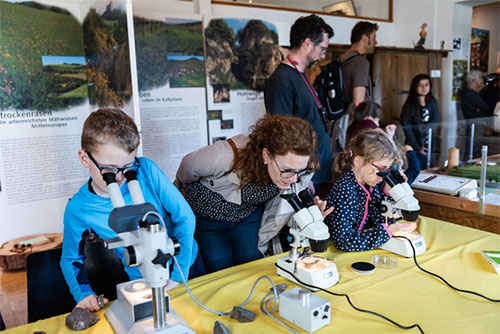
On Saturday, 26 October the HiTech AlkCarb team presented its results at the Naturzentrum Kaiserstuhl in Ihringen. This was after almost 4 years of research focused on the Kaiserstuhl volcanic complex. The HiTech AlkCarb team was pleased with the response of lively interest by the local population. About 250 people, mainly from the Kaiserstuhl area, attended the event. The highlight of the event was the presentation of a digital 3D-Model of the Kaiserstuhl, which supports the construction of the volcanic complex to a depth of over 3 km. In addition, several posters presenting geophysical results in detail were displayed. A number of thematic activities were offered to the numerous children present. Among these were the panning of semi-precious stones, the simulation of a volcanic eruption in a "geowindow" kit, as well as the microscopy of hand specimens and thin sections of the Kaiserstuhl rocks. Many visitors found answers to their questions such as ‘what does the underground look like under my house?’ or ‘what minerals can be found in the rocks in my garden?’ and ‘why did the Kaiserstuhl volcano actually erupt at that time?’. Our multitude of thanks to Mrs. B. Suetterlin of the Naturzentrum Kaiserstuhl for providing the venue and lending a helping hand.
Alexandra Speiser and Claudia Pohl, October 2019
HiTech AlkCarb at at the Geological Society of Namibia 50th anniversary conference, Windhoek, September 2019
The HiTech AlkCarb project is already well entrenched within the geological framework and fraternity of Namibia - both through the many natural laboratories which are an important focus of our studies, and by having representation through ASEC, GeoAfrica and Terratec Namibia as company partners. It was therefore fitting that HiTech AlkCarb could attend the Geological Society of Namibia's 50th anniversary conference, as well as one of the fieldtrips as part of the programme’s outreach actions. HiTech AlkCarb was able to assist with printing of the abstract and conference guides and has two pages detailing the aims and expected results of the project which have been included in the conference handouts. The conference was held over three days between the 2 and 5th of September 2019 with over 150 delegates attending, and a number of HiTech AlkCarb expert councillors, such as Roy Miller and Branko Corner, were in attendance.
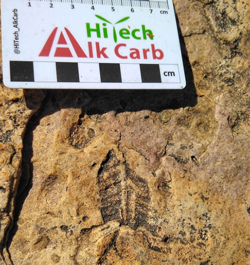
Prior to the conference, I took up an opportunity to attend a field trip focused upon the Brukkaros carbonatite as well as related Karoo age fossils. Furthermore, it was planned to visit some of the planet’s earliest multicellular life. Apart from the beauty of the stark and endless vistas of the southern desert , many of the fossil localities are usually behind locked gates and fences and so I embraced the chance to visit. Some truly miraculously preserved examples of the Ediacaran 'fauna' of at least 560 Ma are petrified as impressions in the rocks of the lower Nama. Preserved Pteridinium, Ernietta and Rangea fossils were placed in geological context by expert guides Dr. Ingrid Stengel and GSN palaeontologist Helke Mocke, the localities providing a testament to the country’s wealth of exceptional geology.
Sunday evening saw the ice breaker being held at the Geological Survey of Namibia museum in Windhoek, with music and some memories from one of the founding members – Jan Joubert – who reminded us how much the industry has changed, but also how much geology is still making new discoveries. Monday morning started with a welcome and keynote address focused on climate change, with Roy Miller presenting a whole new look on flash or more correctly 'deluge' flood events and the meaning of mega clast sizes.
Roger Swart detailed the 570m contour as a shoreline for late Cretaceous sea level at 82 Ma, which can be followed along the coastal plain from central Angola down to Walvis Bay and probably further south. It forms the base level of many of the alkaline intrusions along the near shore coastal plain, such as Brandberg and Serra de Neve in Angola, and in fact may well have covered many eruptive centres, possibly during eruption! This key note address was also part of Roger’s receipt of the award of the Henno Martin medal.
Critical metals were discussed with presentations on hard rock lithium from renowned pegmatites such as Lexicon and Rubicon with resource updates from both, and updates on uranium projects, both secondary and hard rock perspectives. The keynote by Judith Kinnaird presented an overview of uranium deposits and was both simple to understand and appreciated amongst the host of various examples. These updates to economic geology’s development in the country are also vital for generating new ideas and exploration activity. A nice buzz which overshadowed these discoveries was Osino Resources’s announcement of significant widths of gold mineralisation at their Karibib gold exploration programme, so lots of smiling faces.
Paul Macey and colleagues from the Council for Geoscience and the Geological Survey of Namibia updated everyone on the advances in recent mapping in the Warmbad area, southern Namibia. A new map publication of this area is now available.
On the Monday night a spit braai was held at the Old Wheelers club with HiTech AlkCarb sponsoring the event. Pete Siegfried welcomed all the delegates, and short addresses were delivered by Mark Dawe, mine manager at B2Gold Otjikoto Mine, who hosted HiTech AlkCarb's visit last year, and Dr. Heinz–Gerd Roehling, the secretary treasurer of the German Geological Society, who are celebrating their 100th anniversary next year. Members of the Geological Society of Namibia were welcomed to join and attend in 2020.
Tuesday and Wednesday saw continued presentations of many aspects... John Ward managed to get Bob Dylan over the PA with a thoughtful note on dune source, formation and migrations along the west coast by posing the question led by 'yes, an' how many years can a mountain exist, before it's washed to the sea?,... the answer my friend is blowin' in the wind, the answer is blowin' in the wind'...
Alex Speiser (ASEC) engaged with Ms H. Ekandjo from Skorpion Zinc and discussed the importance of community engagement in exploration and mining projects. The Policy Paper "Social licence for exploration/mining in in Europe" by ASEC summarises these aspects under georesource projects such as deep and shallow geothermal drilling and is complementary to these interventions.
Ester Kapuka presented her carbonatite studies during the poster display with a poster detailing REE distribution at the Epembe carbonatite, while Greg Symonds presented posters on radiometric mapping, and use of deep NSAMT – which we have successfully applied at Kaiserstuhl. As a fitting finale Roy Miller completed an hour and a half review of the Damara Orogen – from opening, rifting, drifting, and closure – for all those that had been attending, and also a primer for those who were attending the post conference Damara field trip traverse, probably Roy's last time as leader. A big thank you to all the organisers, friends and colleagues who attended.
P R Siegfried September 2019
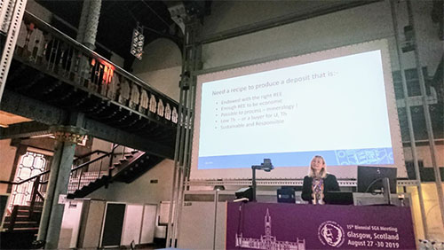
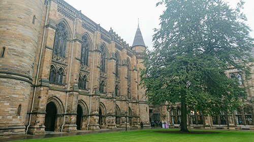
HiTech AlkCarb at SGA2019, Glasgow, August 2019

In late August 2019, over 650 geologists from around the world gathered for the 15th biennial meeting of the SGA (Society for Geology Applied to Mineral Deposits) in the beautiful University of Glasgow. After a superb icebreaker in the Hunterian Museum, the conference began with members of the SGA Council being piped in to the ornate, Victorian–era Bute Hall, which has many famous scientists and academics represented in its stained glass windows. The day started with excellent plenaries from Cam McCuaig, Sarah Gordon, and Mike Russell before the main conference sessions got under way.
HiTech AlkCarb was well–represented at the conference, particularly during the Mineral Resources for Green Growth session, for which Kathryn Goodenough was lead convenor. Two of the keynotes were related to HiTech AlkCarb: Frances Wall gave an excellent keynote on recipes for Rare Earth Deposits, whilst our Expert Councillor Philip Verplanck provided a thought–provoking overview of his research using isotope data to investigate REE mineralisation in carbonatites. Other HiTech AlkCarb talks were presented by Graham Banks, Holly Elliott, Adrian Finch, and Kathryn Goodenough. With plenty of other talks on alkaline magmatism and rare earth element deposits, the conference provided food for thought for the whole project team.
Kathryn Goodenough, August 2019.
HiTech AlkCarb at Goldschmidt2019, Barcelona, August 2019
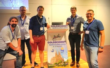
In mid August 2019 more than four thousand geoscientists assembled in Barcelona for Goldschmidt2019 – the world's premier conference on geochemistry. Alkali–botherers were busy at two sessions, spanning Wednesday morning through to curtain close on Friday evening. HiTech AlkCarb members Charlie Beard, Will Hutchison, Michael Marks, Gianluigi Rosatelli and Ben Walter convened Alkaline Rocks and Carbonatites: From Mantle to Mine (and everything in between), while friends at McGill University ran 'Hydrothermal Geochemistry and Mineralogy of Rare Earth and High Field Strength Elements'. With ~50 abstracts and a room packed to bursting the HiTech AlkCarb session promised a diverse view of the latest developments in the field of carbonatites, alkaline rocks, and their critical metal cargo.
1 | Melt Sources
Part one began with a blistering keynote from Sebastian Tappe (U. Johannesburg) entitled 'Views of Plate Tectonics and Mantle Metal Budgets from Alkaline and Carbonate Magmas' (link). Key examples from Greenland and Southern Africa show that metasomatic weakening of the mantle lithosphere by pervasive alkaline and carbonatite magmatism affect metal endowment and commonly precede continent fragmentation. Next to the stage was Emma Humphreys–Williams (NHM) presenting a 'Global View of Alkaline Rocks and Carbonatites' and officially releasing our digitised online catalogue that represents more than three decades of dedicated compilation by Alan Woolley (NHM). Further presentations used stable and radiogenic isotopes to constrain the nature of source regions for alkaline rocks and carbonatites and covered rift, collisional and LIP–related systems. HiTech AlkCarb members Will Hutchison presented on sulphur isotopes as a probe of crustal recycling and fluid evolution, and Charlie Beard spoke about subducted sediments as a source for REE in mineralised post–collisional alkaline–carbonatite systems. After a wonderful afternoon of talks we headed to the main hall for our poster session which gave all the delegates a chance to chat science over a beer or two.
2 | Magma Chamber Processes
Part two navigated the fiddly subjects of immiscibility and element partitioning with a diversity of approaches including experiments, melt inclusions and fluid inclusions. Delegates touched on how carbonatites come to be, under which conditions they can become REE–rich and provided methods for reading the mineral record of metal enrichment. Tibor Guzmics kicked off the session with an informative talk on natrocarbonatite genesis and invited speaker Olga Vasuyukova (McGill University) walked us through the amphibole record of REE enrichment at the unusual and aptly–named Strange Lake peralkaline granite, Canada. Strong talks from PhD students Zineb Nabyl, Johannes Giebel and Cyrielle Bernard covered carbonatite genesis, Phalaborwa phoscorite and Brandberg clinopyroxene. HiTech AlkCarb presenters Ben Walter, Michael Marks and Gianluigi Rosatelli spoke about our work at the Kaiserstuhl and Vulture carbonatite complexes in Germany and Italy.
3 | From Mantle to Mine
The final chapter linked together phase relations, constraints on source composition and the characteristics of mineralisation. Daniel Weidendorfer opened with an experimental study of oceanic carbonatites. HiTech AlkCarb presenter Pete Siegfried (GeoAfrica) showed the influence of laterite weathering in upgrading of deposit grades and Sam Broom–Fendley (CSM, Exeter) showed us how an O-isotope thermometer he was calibrating became unusable once a labelling error in a publication was corrected. We left well worked, happy and filled with new ideas. Thanks to all of the presenters for sharing their research and to the student helpers for uploading the slides and facilitating such smooth transitions between presentations.
Charlie Beard, August 2019.
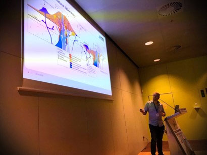
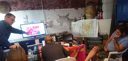
HiTech AlkCarb Leapfrog Modelling Workshop, Monchique, August 2019
The second stage of the HiTech AlkCarb Kaiserstuhl working group’s 3D Leapfrog visualisation project has been completed. The objective was to schematically construct the Kaiserstuhl Volcanic Complex (KVC) inside the data void on surrounding 2D seismic reflection and resistivity subsurface profiles. This task follows the province scale structure and host rock definition conducted in June 2019. Progressing into this district scale environment enables use of the detailed geophysical data collected extensively across the KVC by Terratec over the last three years.
The modelling exercise was conducted on the 12th and 13th of August, 2019 with Klaus Brauch and Claudia Pohl from terratec, Pete Siegfried from GeoAfrica, and Leapfrog modelling specialist Toby Dawborn running the process. Ben Walters, Graham Banks and Greg Symons Skyped and WhatsApped in their input and advice at various times.
The first day was allocated to the first step of the process i.e. defining the igneous geology using published surface geology maps by simplifying the range of lithologies into eight categories. During the simplification exercise we realised that some of the extrusive tephrite flows display a strong magnetic remanence, while others demonstrated a normal magnetic response. Fairly extensive areas displaying subdued or quieter magnetic response could also be noted towards the north and west, that we interpreted to reflect Quaternary sediment covered tephrite flows.
The entire range of sodalite monzogabbros were lumped into two categories; the highly magnetic ones and the more homogenous but still magnetic 'stock/s'. The combination of different geological map and geophysical sources enabled us to draw the various rock units as surface lithology polygons. We extrapolate them into the subsurface by utilizing the geophysical magnetic and gravity voxi model cells produced through depth–unconstrained modelling. At its most simplistic we learnt that to construct 3D visualisations for subsequent geomodelling the skill is to distil and digitise map and drill hole geology to help create hypotheses about the subsurface.
The second day was to define the igneous lithologies of the subsurface volcanic edifice. The optimal way to do this is to create a 1:100 000 scale fence diagram of the magnetic and gravity data using 3 east–west cross sections and 3 north–south sections. While working through this part of the process a number of software compatibility challenges emerged, that we conquered and learned from. The first challenge related to stretching of the colour bars in the sections that we produced in GeoSoft in 2017. Thankfully Michael Tauchnitz on the Terratec 'helpdesk' in Germany came to the rescue. The gravity data could then be properly integrated into lithology modelling by presenting lithological contacts as zones of steepest gravity signal gradient.
The second challenge emerged as we moved the magnetic voxi model depth slices into 3–D space. Many of the magnetic anomalies that appear at depth may actually be a subsurface projection of the difference between the inverse or normal magnetic responses of the surface extrusive flows. Greg resolved that issue by rapid reprocessing of the voxi magnetic models. A further observation was that areas underlain by strong and inversely magnetized flows are characterised by near–surface gravity contours apparently being locally depressed, and these features need to be explored further. One thing was clear during our workshop: despite much research over decades there is still an acute lack of knowledge and geospatial display of the extrusive components of the Kaiserstuhl for 3D model building (although lush vegetation and agriculture doesn’t help the geologists).
In conclusion, the collaboration of geophysical, geological and 3D model building expertise is fundamental to completion of a 3D visualisation of the Kaiserstuhl Volcanic Complex. A big take–home message is that defining individual tephrite flow units can help with their mapping despite, as Ben says, 'so few outcrops, that are weathered to clay minerals and leached, that they have few petrological features to map over distances'. It will be exciting to see if the paleomagnetic data will enable us to temporally correlate various units. The Kaiserstuhl 3D visualisation will now progress into the prospect scale. From there we can start hypothesising whether we have new exploration indicators for targeting and discovering REE–HFSE mineralisation. Watch this space.
Pete Siegfried and Graham Banks, August 2019.
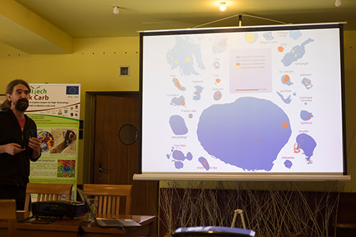
Catalogue of Alkaline Rocks and Carbonatites of the world, August 2019
The definitive account of all the world’s alkaline igneous rocks and carbonatites can be found in the four-volume series of books published by Dr Alan R. Woolley, of the Natural History Museum in London, UK. The first volume, which covered North and South America was published in 1987; the second on the former USSR, in 1995; and the third, covering Africa, in 2001. The rest of the world is described in volume 4, to be published in September 2019. The content of these books has now been digitised by the HiTech AlkCarb project, with the work being led by Emma Humphreys–Williams and Alan Woolley. The online catalogue of alkaline rocks and carbonatites currently represents a snapshot of what was known about each locality when the book was published, and a facility to allow updates for each entry will be added soon.
Emma Humphreys–Williams and Dr Alan R. Woolley, August 2019.
Constructing a digital, dynamic 3D model of the subsurface of the Kaiserstuhl mineralised district, May 2019


The Kaiserstuhl Volcanic Complex (KVC) is a REE–HFSE mineralised alkaline igneous district in SW Germany. It intruded into the Upper Rhine Graben sedimentary basin during the tectonically active (Alpine compression) Miocene epoch. The KVC district is a 'branch' of the SW Germany Variscan–Miocene Carbonatite REE–HFSE mineral system. During the last few years the HiTech AlkCarb working group has identified new indications of REE–HFSE mineralisation in magmatic, sedimentary and regolith facies.
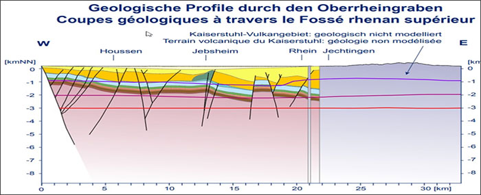
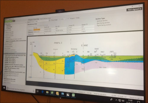
HiTech AlkCarb has collected a large volume of geological, geochemical and geophysical datasets, spanning province to millimetre scales, and down to 3 km deep. We can now use these data to constrain: (a) the 3D geometries of the constituent igneous bodies and, (b) their prospect–scale REE–HFSE mineralisation potential. However, the KVC subsurface is currently an interpretation void (Figure 1) with no known 3D model and only two sketch cross–sections through it published.
To integrate the geophysical signatures recorded and what they may indicate about the subsurface igneous bodies, the HiTech AlkCarb team first needs to geospatially model the evolution of the KVC and its fractured host rock volume.
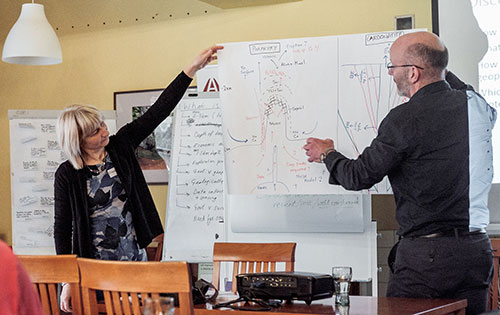
This started in May 2019, with HiTech AlkCarb holding a 3–day workshop to start building the 3D geology below and around the KVC. The usual KVC suspects were there, with representatives from Terratec Geophysical Services, the Geological Survey of Denmark and Greenland (GEUS), and GeoAfrica Prospecting Services. Ben Walter represented Eberhard Karls University, Tübingen, and has recently moved to Karlsruhe Institute of Technology. And we welcomed Toby Dawborn into the team as software 'pilot'.
The first step was to integrate our regular igneous, sedimentary, tectonics and geophysical expertise to build the 'big picture' magmatic–tectonic context of why the KVC is where it is. Each team member had a role to enable maximum model–building rate and knowledge integration, e.g. the literature readers, the cross–section sketchers (Figure 2), the georeferencers, the software pilot and the time–keeper. We georeferenced and interpreted reliable published maps through the continental then the province scales. It was fun to collectively imagine how the Upper Rhine Graben was sequentially filled then partly eroded during episodes of being stretched, squeezed, sheared, intruded by the KVC and uplifted (Figure 3). The KVC seems to have intruded up a strike–slip fault system that temporally and spatially coincided with the NW–ward advance of the Alps orogenic wedge. This aligns with the logic that a mineral system requires a geodynamic trigger to cause overpressure of magma, before it moves up pre–existing lithospheric structures to the upper crust.
Next we assembled a district–scale geospatial database of reliable public domain images, that would form the frame to 'hang' our 3D model on. It was important to assess the 'strength' (representativeness, vintage, volume, accuracy) of each published map, cross section and tectonostratigraphic evolution chart, to determine what confidence and certainty can be placed upon them (Figure 2); We don’t want to build a house of cards. Then we extrapolated fault traces from surface geological maps and interpretations of subsurface geoelectric (Figure 4), gravity and seismic data to make and connect 3D fault planes. A key learning is how much value is available within sedimentary basin and tectonic datasets to guide igneous–related mineralisation models.
We ultimately want to predict how weak zones in the upper crust could have facilitated KVC magma migration, and how REE-HFSE mineralisation may therefore be distributed within the fault–fracture network. Therefore, we divided the KVC host rock sequence by faults. Next we divided the intra–fault rock volumes rheologically to represent their brittleness during magma intrusion, and then incorporated these chrono–rheological rock units into our model from Basement upwards, i.e. the way the Upper Rhine Graben filled (Figure 2). Whilst Toby digitised the faults and rheologic units west of KVC (digital modelling) Pete and Klaus prepared the next inputs, by sketching how the faults and rheologic units may continue below the KVC (predictive modelling). Time flies when you are having fun and suddenly it was the end of the workshop.
HiTech AlkCarb is now progressing towards the first known 3D model of the KVC subsurface, with fault planes and chrono–rheological units defined and being digitised (Figure 2). We will soon be ready to display our interpretation of the deformed sedimentary basin into which the KVC intruded. After that we can start integrating HiTech AlkCarb’s data volumes to conceptualise the shape of the KVC igneous complex, and its potential REE–HFSE–bearing branches. Watch this space...
Graham Banks and the Kaiserstuhl 3D modelling team, May 2019.
Workshop in Tübingen, November 2018

In November 2018, Tübingen University hosted a project workshop on the geomodel for Kaiserstuhl and the wider alkaline province in SW Germany. This was an opportunity to present the most up to date information on the varied Kaiserstuhl investigations, including the ongoing natural source magnetotelluric (NSMT) data processing, the hypotheses for mineralisation being tested using geological data, and progress on the design of a mineral systems approach that utilises the Kaiserstuhl Volcanic Complex and SW Germany as a prototype. Most participants were HiTech AlkCarb members, but Dr Jens Grimmer (Karlsruhe Institute of Technology), a structural geologist specialising in the structural evolution and subsurface interpretations of the Upper Rhine Graben, was invited to attend and share his expert knowledge with the group.
The first day (28th November) saw presentations delivered on a number of subjects. These included a recent synthesis of the geochemical and textural differences between pyrochlores from different parts of the Kaiserstuhl carbonatite, and what this means for melt evolution and the precipitation of these minerals . Detail on the reaction mineralogy was given by Simon Braunger and the structural context by Johannes Giebel and Ben Walter (all University of Tübingen). Ben further summarised the major and minor chemistry of the pyrochlore and the role of wall rock or entrainment of silicate material to change the bulk chemistry and 'force' pyrochlore precipitation – an important new finding. The relative enrichment in REE in accompanying apatite is also potentially affected by this mechanism and has important economic considerations in what type of apatite carbonatite one may be targeting.
Bjorn Heincke (GEUS) presented the latest NSMT data processing stage. This is the natural source magnetic information and gives us some insight about subsurface heterogeneities at Kaiserstuhl at depths of over 500 m to >1 km. After detailed review of the station raw data, which amounted to 34 individual stations, the methodology of removing identifiable frequency noise is now underway. The railway electrification at 16 Hz, power network at 50 Hz and intense high frequency data (courtesy of 3 microwave communication towers lodged on the top of the Kaiserstuhl) are sources of interference already identified. The cause of a number of other interferences, such as the possible goat–proof electric fence of Ohrberg, were discussed. Finally, the resultant depth sections show solid mass increase with distinct boundaries at the edges of the mapped intrusion, with one interpretation being a degree of westward tilt to a cylindrical body.
Klaus Brauch (Terratec) presented an up–to–date overview of all the geophysical determinations, including the most recent gravity data for the Kaiserstuhl. Graham Banks (GEUS) aims to compare the gravity–derived, district–scale, horst and graben interpretation with mapped salt walls and diapir locations. The migration of seismic data as well as the integration of this information into the Kaiserstuhl geomodel is a productive advance.
Graham Banks updated the workshop on progress on the minerals systems approach and an overview of his recently submitted manuscript. The province–scale critical elements for mineralisation in alkaline rocks and carbonatites, discussed at the meeting in Copenhagen, have been applied to southern Germany. Discussion of the major faults, geodynamic trigger causes, and the region’s tectonic settings through the Cenozoic were presented using palaeo–plate reconstruction maps and movies. The group then thoroughly enjoyed translating province–scale fertility into mappable criteria, integrating geophysics, petrology and geochemistry
Jens Grimmer gave a fascinating and well defined history of the Upper Rhine Graben (URG) using extensive new stratigraphic knowledge from geothermal drilling and seismic data as well as provenance studies. LiDAR data assist greatly with the structural analysis at prospect scale. The question of the Kaiserstuhl being located on the major Tuniberg Fault or on a dilatant jog on this major control of the basin tectonics was well debated, and the evidence for Neogene transpression and the possible presence of relay ramps as district–scale weak zones were highlighted.
Pete Siegfried (GeoAfrica) completed the day with a summary of controlling structures on the emplacement of carbonatites on a province scale which are not related to extensional rifts.
Day 2 saw a visit in the morning to the many research laboratories and important equipment available in the department at Tübingen. Equipment necessary for high pressure, high temperature experimental studies was demonstrated. The dark room laboratory for cathode luminescence (CL) as well as latest iteration XRD and XRF laboratories were then viewed and processes explained, and the team were impressed by the facilities available. The afternoon planning and Kaiserstuhl structural collation extended well into the postprandial experience of the Africa House Ethiopian dinner, and saw extended discussion advancing on the structural history and fault architecture of the URG.
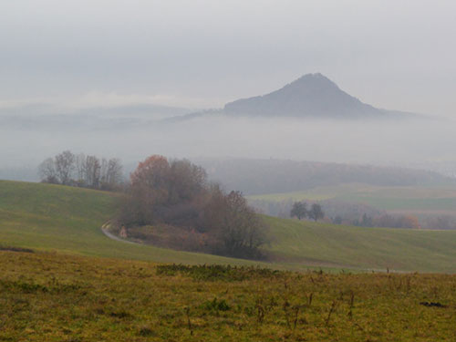
The final day saw a field trip to part of the Central European Alkaline Province and the late Miocene phonolite and melilitite intrusions of Hegau in southern Germany. We were led by Dr. Udo Neumann (University of Tübingen). The first stop was a misty overview looking towards the south (Figure 1) with in the distance a suggestion of snowy crags – the Alps. The landscape is dominated by inselbergs, many formed by alkaline plugs which make up two generations of intrusion – early (12–10 Ma) melilitites which were immediately preceded by a protracted period of tuffaceous pyroclastic and phreatic activity (15–12 Ma) including the formation of a number of diatremes, and later phonolite plugs (10–7 Ma).
The second stop was fantastically columnar jointed intrusive nephelinite long used as a source of railway ballast. Diatreme facies tuffs were also noted. An important fossil site with an Eohippus skeleton is located in an adjacent possible maar lake.
A stop at the side of the road followed and showed the appearance of lapilli and lower crustal gneiss assemblages. Apatite is enriched in some of these lapilli up to 21%. An impressive phonolite plug with extensive columnar jointing was visited at Hohenkrahen (Figure 2) and finally more Deckentuff pyroclastics were visited and sampled at Hohentwiehl Weingut.
A superb and insightful meeting helping us develop the geomodel for SW Germany and Kaiserstuhl at all scales. Thanks again to Michael Marks for co–ordinating and to everyone involved for making a difference.
Peter Siegfried and Graham Banks, December 2018
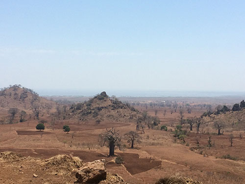
Geophysics, mineralisation models and best environmental practice: fieldwork in Namibia, April 2018

The HiTech AlkCarb team and some seasoned industry professionals completed an insightful and valuable field study in Namibia during April 2018. We gained much new knowledge and collaboration in the excursion’s three target themes:
- Integrating geophysics with mineralogy of alkaline silicate rocks and carbonatites (which could host EU–defined critical materials)
- Improving mineralisation models of these rocks in the field
- Learning about some environmental and community best practices around mineral extraction and beneficiation processes (e.g. around the Otjikoto gold deposit)
Namibia is a large country and well–endowed in natural resources. Its economy is heavily dependent on the extraction and processing of minerals for export, including diamonds, copper, gold, uranium, lead, tin, zinc, salt and gemstones. Mining accounts for 11.5% of GDP, yet provides more than 50% of foreign exchange earnings. Although not currently exploited, there are 28 carbonatite bodies in Namibia.
The HiTech AlkCarb team has now entered the geomodels design stage of this four-year project. So the work in Namibia set in motion some of the cross–pollination required to build a holistic geomodel:
- Placing magmatic features within structural context
- Geophysical measurements as mineralogy indicator tools
- Linking mineral prospects (e.g. Eureka) to craton evolution
- Ensuring stakeholders are reassured about exploration and mining impacts
My personal aims for the trip were also achieved:
- Viewing the scale of the mineral industry's and HiTech AlkCarb's challenges to "explore deeper"
- Integrating mineralogy and geophysics at outcrop scale
- 'Sowing seeds' to grow fluid overpressure and host–rock deformation context for HTAC's natural laboratories
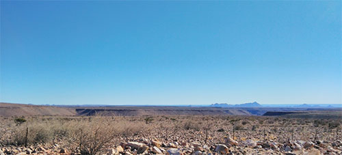
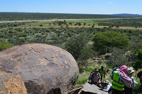
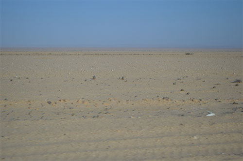
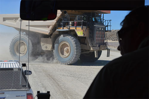
Traversing Namibia's vast, largely flat wilderness makes clear the fundamental role of geophysics for the minerals industry and HiTech AlkCarb in "exploring deeper". The typical landscapes (Photos 1 and 2) and B2 Gold's Otjikoto gold mine (photos 3 and 4) epitomise the challenges of selecting where to explore, then how to define and risk prospects, where so much land is blanketed by calcrete (a hard calcium carbonate duricrust) and thorny vegetation. Integrating regional–scale geophysics datasets into tectono–magmatic models is crucial for exploration companies and HiTech AlkCarb researchers to characterise prospective mineralisation in areas hidden under cover. The Otjikoto gold deposit was targeted due to its single, poorly resolved anomaly on regional magnetic data; there was no obvious indication of it at surface. Witnessing B2 Gold's full exploration–production workflow, from prospect definition through efficient gold processing to reassuring community relations, was a privileged glimpse of the entire mineral industry spectrum.
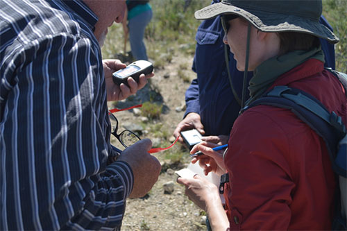
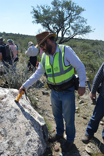
Once a prospect has been identified the geophysicists, geochemists and geologists can huddle together around hand–held radioactivity and magnetic susceptibility tools to link, then build predictive models for, rock mineralogy within minutes. In photos 5 and 6 our colleagues ground–truth their lithology models. "Aaahaaah! So the low radioactivity and moderate magnetic susceptibility areas are the nepheline syenite rocks". These sample–scale techniques are also important for identifying environmental geohazards. "This ferroan carbonatite has 1800 counts per second radioactivity. Drillers will need safety gear to prevent inhalation of dust".
The fieldwork itself brought us to several locations fundamental to deciphering Namibia's alkaline magmatic systems and potential critical materials deposition: Otjikoto working gold mine (Photo 3); The Okurusu fluorspar mine; the Kalkfeld intrusions (Photo 1); Lofdal HREE deposit; the Amis Gorge of Brandberg mountain; and the Eureka REE deposit. The field trip also included several short workshop slots with insightful guest speakers. In one of these, Alex Speiser, who leads the environmental work package for HiTech AlkCarb, and guest speaker Auriol Ashby talked us through several other key environmental considerations, including: rehabilitation of exploration trenches; stakeholder relations at Kaiserstuhl; and how to maximise the gains to, and alleviate the concerns of, residents around a large mine. We look forward to integrating stakeholder considerations into the HiTech AlkCarb geomodels.
Integration is crucial for the success of any geomodel, and so we started to link mineralogy and petrology with fluid emplacement mechanisms, using the shapes of magmatic bodies. Planar magmatic bodies and breccias give valuable information on differing depths of mineralisation; they form different shapes depending on the fluid pressure versus the confining stresses of the rocks they are squeezing into. The fieldwork presented us with several textbook examples of how to interpret magma emplacement conditions (Photo 7).
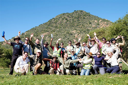
And now the HiTech AlkCarb team members and the industry guests (photo 8) go back to their research topics each wiser about integrating geophysics with mineralogy, improving mineralisation models via fluid pressure and tectonic context, and environmental and community best practices around mineral extraction and beneficiation processes. Thanks to everyone for your contributions into foundations of our upcoming holistic geomodels.
The HiTech AlkCarb team are very grateful to our invited participants for imparting their Namibia carbonatite and gold wisdom: Scott Swinden, Mark Dawe, Branko Corner, Roy Miller, Auriol Ashby, Alan Marlowe, Jeremiah Simon and Ed Loye. Several companies and farmers granted us access to their lands and mines, and so we thank the staff of Gecko, B2Gold (who hosted us for two days), E–Tech Metals and Namibia Rare Earths, as well as Ralf Warta and Andreas Palfi who showed us the Aris quarry. In addition, much gratitude to all the many trip, vehicle, accommodation, food and sample export enablers within the technical group and their colleagues behind the scenes.
Graham Banks, May 2018.
Advancing Geomodels for HiTech metal deposits: Expert Council 4, Moravian Karst, Czech Republic, March 2018

With new additions to the HiTech AlkCarb team, and the geomodels work package set to start, the time was ripe to collate the knowledge of the team with help of some expert councillors. Hosted by Jindrich Kynicky in a small hotel deep in the karst canyons north of Brno, this meeting was the perfect setting to stir our collective melting pot of ideas. Many arrivals were delayed by an untimely closure of Munich airport, but despite this, the air was buzzing with ideas from the first evening through to the last. Members of the HiTech AlkCarb project were joined by invited experts from Australia, Canada, China, the UK and USA.
The first session, themed 'shallow plumbing systems' covered a breadth of geological approaches and highlighted the rich variety of environments that can host deposits of the critical metals. Here, talks covered geometry to geochemistry, petrology to element partitioning, and porphyries to peralkaline volcanic systems, setting the stage for fruitful discussions to come.
The latter half of day two swung toward geophysics, and focused largely on the Kaiserstuhl carbonatite, our best characterised natural laboratory. Valuable insight from the teams at the University of Tübingen and Terratec Geophysical Services was added to by Bill Peters of Southern Geoscience Consultants, who has amassed a wealth of exploration geophysical data from alkaline complexes and carbonatites around the world.
Once the final session rolled around on Wednesday morning, we were all wondering what a geomodel was! Kathryn Goodenough kicked off the day with a summary of current definitions, clearly showing that a variety of approaches exist, and that a geomodel should be tailored to its intended application and target end users. This session also featured valuable insight from Anne McCafferty and Philip Verplanck (USGS), who together published a comprehensive mineral deposit model for carbonatite and peralkaline intrusion–related REE deposits. New GEUS postdoc Graham Banks captured the room with a mineral systems 'decision tree', proposing how we might move forward.
In a series of 'sandpit' discussion sessions, it was decided that we should amass our collective knowledge and data into an easily accessible, shared format to permit rapid testing of hypotheses. During the first two years of the project, the natural laboratories have been carefully characterised and now, where possible, they may be grouped to permit thorough comparisons. Depth of emplacement might be important, as might variability in melt source compositions, effectiveness of metal concentration mechanisms, and the characteristics of traps for mineralisation.
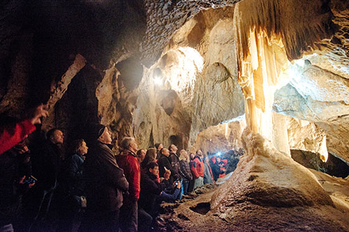
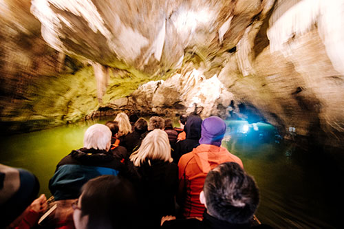
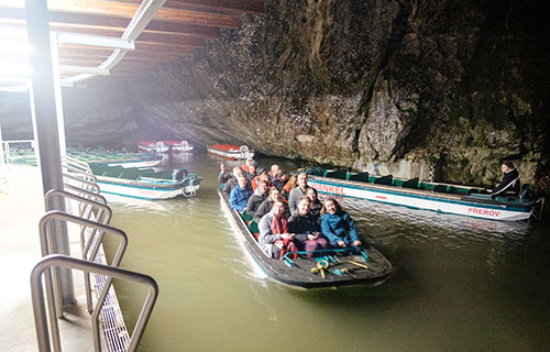
The visit was rounded off by an excursion to another type of carbonate system: The beautiful caves that surrounded our hotel. Intricate passages, some natural, some blasted open by the Czech military, were navigated by boat and on foot. On this subterranean journey we couldn't help but wonder: What would a carbonatite karst look like?
Charlie Beard, March 2018
HiTech AlkCarb Open Day and fieldtrip at Kaiserstuhl, October 2017

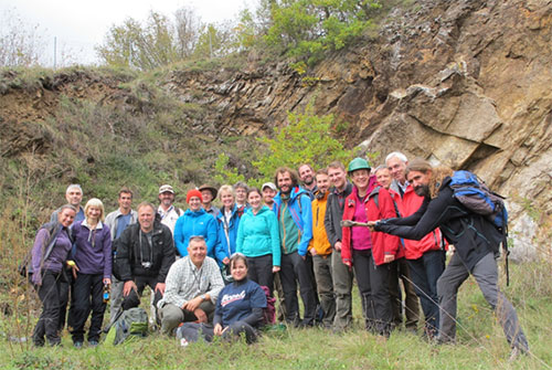
In October 2017, after nearly 20 months of work conducted at the Kaiserstuhl, the HiTech AlkCarb team decided it would be a good time to provide some feedback to the general public. Hence, on Sunday 8 October the HiTech AlkCarb project invited members of the public to an Open Day at the Naturzentrum Kaiserstuhl in Ihringen (http://www.naturzentrum-kaiserstuhl.de). It was planned to introduce the geological and geophysical findings of the work conducted at the Kaiserstuhl. The exhibits focused on the geophysical work, water sampling and geology. The public was introduced to the general uses of rare earth elements (REE) and what importance carbonatites have as hosts for REE deposits, and also to a wider understanding of geological processes. The day offered activities for children such as building your own 'earth' and finding hidden magnets, and opened with a live mini–volcano welcoming the attendees. The Open Day was advertised in the local municipality newspapers and in local newspapers. On the day some 150 people came to the Naturzentrum Kaiserstuhl to interact with the HiTech AlkCarb team. The day ended with a talk by Dr. Ben Walter, giving a detailed overview of the geology of the Kaiserstuhl, in the Rathaus conference hall.
Mr. Kai Kircheldorff from the Badische Zeitung interviewed Prof. Frances Wall and Dr. Ben Walter, and a very positive article was published in the newspaper on 10 October 2017 (http://www.badische-zeitung.de/ihringen/der-kaiserstuhl-ist-eine-beispielregion-fuer-seltene-gesteine--143196319.html).
The Open Day was followed by the Kaiserstuhl Natural Laboratory fieldtrip and workshop, which was organised by the team from Eberhard Karls University Tübingen and Terratec Geophysical Services. Some 20 participants of the HiTech AlkCarb team were present, together with four external invited experts. All participants met in the evening on Monday 09 October 2017 at the Kapuzinergarten Hotel in Breisach and the Kaiserstuhl Natural Laboratory fieldtrip was opened by an introduction by Prof. Dr. Gregor Markl.
At the beginning of day 1 the participants were shown the structural damage to the buildings at the town of Staufen, which has led to a generally negative public perception of borehole drilling in the area around the Kaiserstuhl. In Staufen seven boreholes were drilled to establish borehole heat exchangers (BHE). Unfortunately, at one of the boreholes water entered layers of anhydrite which reacted with water and became gypsum. This can lead to up to a 61% increase in volume of the layers. The damage caused by this process is visible in the Town hall and adjacent buildings in Staufen.
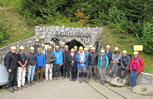
The first day focused on outcrops of mineralised veins along faults which separate the Triassic sedimentary rocks (part of the Rhinegraben Mesozoic sequence) from the gneissic and granitic Variscan basement rocks of the Black Forest inlier. This was followed by a visit to the Teufelsgrund mine (Münstertal), which is a typical representative of the vein related fluorite–barite–galena quartz–dominated veins formed by fluid mixing. The mine is nowadays open to the public. The day ended at the Almgaststaette Kälbelescheuer where presentations on carbonatites and alkaline rocks by invited experts Dr. Anton Chakhmouradian and Dr Stefano Salvi were followed by supper.
The second day started with an introduction of the geology of the Kaiserstuhl by Dr. Ben Walter. The field day was dedicated to the extrusive rocks of the Kaiserstuhl. We visited outcrops showing tephrites, phonolite satellite intrusions at the Kirchberg, tephritic ash layers, carbonatite lapilli and lava, as well as monchiquite and limburgites (olivine nephelinites and basanites). This was a perfect hot autumn day which ended at the Rasthaus Lenzenberg with the most stunning views over the Rhinegraben towards the South. After the HiTech AlkCarb management meeting, a superb buffet of local specialities fed the hungry participants.
The third and final day was dedicated to the intrusive rocks including the carbonatites of the Kaiserstuhl. The different rocks were seen while walking a 10 km traverse from the east to the west of the Kaiserstuhl centre. We were able to investigate the sheeted nature of the intrusions around the margins of the Kaiserstuhl carbonatite; understanding this contact zone is very important for development of the HiTech AlkCarb geomodels. Entertaining and lively discussion was order of the day with Anatoly Zaitsev, Anne McCafferty and Klaus Brauch ending the day with presentations. Excellent supper at our wonderful host Ingelbert Kai's establishment finished the tour in an admirable fashion.
A well organised fieldtrip, during which many fruitful discussions were held, ended on Friday morning when everybody departed to incorporate the new ideas and findings into their work.
Alex Speiser and Pete Siegfried
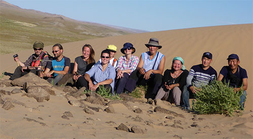
Second HiTech AlkCarb field visit to Mongolia, September 2017

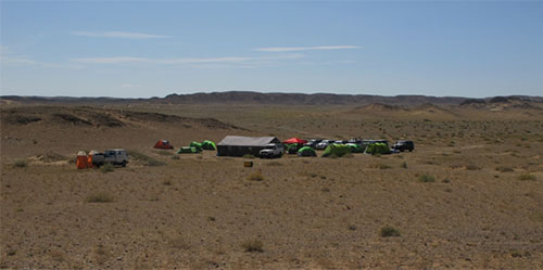
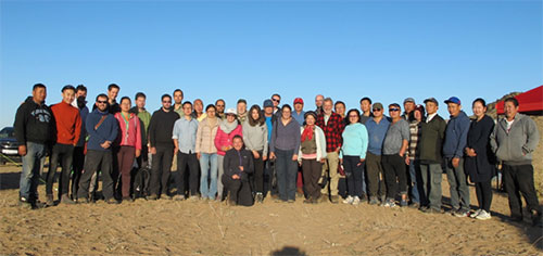
The alkaline and carbonatite complexes in Mongolia are an extremely important natural laboratory for HiTech AlkCarb, and so the project team decided that a second trip to the country would be essential. This trip took place in September 2017, led by Jindrich Kynicky. Arrival of many team members was delayed due to storms in Amsterdam, but those that it made it on time were able to participate in a half–day workshop on the Mongolian alkaline complexes. The next morning, the whole team assembled in Ulaan Baatar, and we set off to the Gobi Desert in a convoy of eleven vehicles. Members of the HiTech AlkCarb project were joined by invited experts from Australia, the UK, France, China and Russia, as well as collaborators from German, Czech and Mongolian universities. The logistics of the trip were very ably organised by the Mongolian Society of Economic Geologists, who provided impressive transport and catering as well as organising accommodation.
The first day was spent driving south across the vast and empty Mongolian landscape, with only the occasional yurt or camel to enliven the view. After a night in a roadside hotel, we arrived at the Mushghai Khudag complex at lunchtime. This is an excellent example of the shallow levels of an alkaline–carbonatite complex, with trachytic lavas cut by shallow–level intrusions of rhyolite, trachyte, carbonatite, and apatite–magnetite rock, and associated fluoritite veins. It will provide crucial information for the shallow–level plumbing part of the geomodels to be developed by the project. Our logistics team set up a great field camp in the middle of the complex, and we were able to spend two days studying the geology. An extra highlight was the superb display of stars at night, with no light pollution around the camp.
From Mushghai Khudag we drove to the Southern Gobi Rift Zone, crossing mile after mile of open gravel plains before passing the Oyu Tolgoi copper–gold mine, one of the world's largest copper–gold deposits. That evening we settled in to a small hotel in Khan Bogd village, our home for the next few nights.
The Khan Bogd pluton is a huge peralkaline granite pluton, some 40 km across, and easily visible on satellite images of the Gobi Desert. It is very well exposed, with a landscape of granitic tors separated by gravelly hollows, standing above the surrounding desert. A distinctive feature of this pluton is the abundance of roof pendants of country rock, forming some of the higher hills. Around the margins of the pluton and the roof pendants, stunning pegmatitic intrusions can be seen in the granite. Many of these intrusions have a banded form, with alternating pegmatitic and aplitic layers. Rare zirconosilicate minerals such as elpidite and armstrongite are common, and at one locality we were lucky enough to find the very rare mongolite. Where the pegmatites intrude country rock, they have caused extensive metasomatism (fenitisation).
After three days on Khan Bogd, we drove back to Ulaan Baatar, where a final day was spent at the Museum of Geology in the Mongolian University of Science and Technology, packing up samples and preparing them for shipment. Our colleagues in Mongolia are now undertaking a lengthy permitting process, and we look forward to the arrival of the samples in the near future!
Kathryn Goodenough
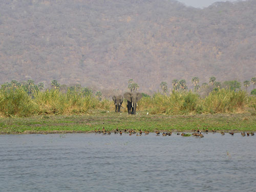
HiTech AlkCarb fieldtrip to Greenland, June 2017
Representatives from the HiTech AlkCarb project and invited experts, Tom Andersen from the University of Oslo and Paul Boon from the University of Tübingen, visited the Gardar province in SW Greenland in June 2017 on a field trip organised by Sam Weatherley from GEUS. The theme of this fieldtrip was to review some classic examples of layering in magmatic systems with the aim of fuelling discussion on their formation mechanisms. Another aspect of the HTAC project is to understand the processes that occur in the roof zones of large intrusions, particularly in relation to the volatile activity, and the Gardar is an excellent place to study this. Renowned for spectacular geological exposure, agpaitic rocks (see Marks and Markl, 2017 for a review) and gorgeous eudialyte, the group was incredibly excited to (re)visit some of the world's most infamous rocks!
The trip commenced in Narsarssuaq where we joined the Kisaq, our vessel for the two weeks. Kisaq means anchor in Greenlandic – very reassuring for those of us without sea legs! The group sailed west to Grønnedal–Ika and travelled east over two weeks visiting both carbonatites and alkaline igneous intrusions.
First stop was the Grønnedal–Ika carbonatite–syenite Complex – here the group looked at one of the few carbonatites in the region and its relationship to the syenite. Adjacent to this is the Ivittuut peralkaline granite which was worked in the past for cryolite – historically used as a flux for processing bauxite for alumina. The group shared outcrops with an equally surprised cruise ship of tourists! In the Ikka Fjord the group sailed in a zodiac to see submarine tufa columns that form on alkaline springs by abiotic precipitation of the metastable, cold water marine ikaite (CaCO3.6H2O). The alkaline springs are sourced from meteoric water that have percolated through the Grønnedal–Ika complex. Once removed from cold water the mineral degrades to other carbonates over a period of hours.
Having admired some giant feldspar dykes en route, the group arrived at the infamous Ilímaussaq Complex. This multiphase alkaline to peralkaline intrusion displays some incredible magmatic layering, and is host to two of the most significant potential REE deposits in Greenland. To the north of the Tunalliarfik Fjord lies the Kvanefjeld (REE–U–Zn) deposit owned by Greenland Minerals and Energy Ltd., while the privately owned TANBREEZ Kringlerne REE deposit lies to the south.
The group travelled by helicopter to the Motzfeldt intrusion, which has a preserved roof zone – this was slightly cut short due to the weather closing in and a planned trip to see the inverted layering at Klokken the following day was unfortunately not possible.
The trip concluded with a day on the Qassiarsuk carbonatite that has both extrusive and intrusive facies preserved. This is a spectacular coastal exposure of lavas and a diatreme facies on the site where Eric the Red settled in Greenland.
Eimear Deady
HiTech AlkCarb work in the laboratory
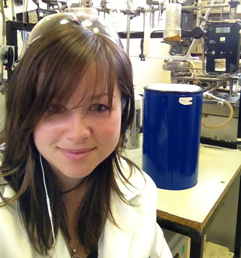
After the excitement of collecting your samples in the field, a lot of behind the scenes lab work is undertaken before you achieve publishable results. These results allow us to better understand the geological processes that occur within igneous complexes, and contribute to the developing HiTech AlkCarb geological models. The aim is for these models to be eventually utilised by exploration companies, to more efficiently pinpoint important deposits of critical metals such as the rare earth elements (REE) and niobium (Nb).
The first step along this road is the obligatory radiation checks to see whether your samples are actually allowed in the labs, and the subsequent documenting (labelling, photos etc), before the samples can be submitted for preparation. The result of preparation can be a polished thin section, polished block, powder or whatever your analysis of choice requires.
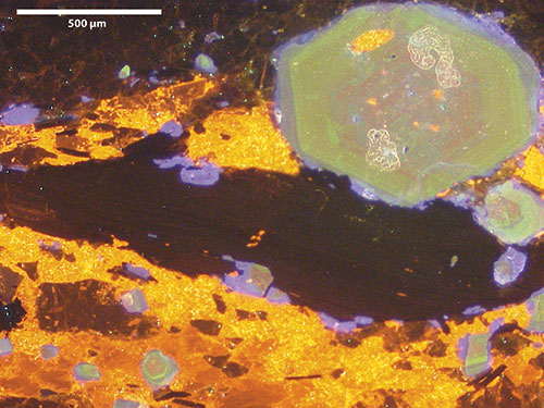
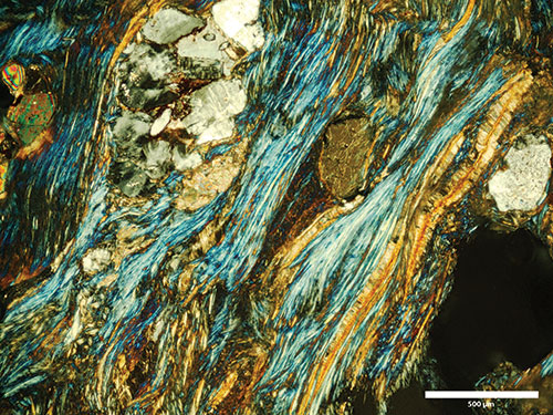
My samples are fenites, which are metasomatised country rocks that have been altered by fluids expelled by cooling and crystallising carbonatite or alkaline–silicate intrusions. Once I have my thin sections made I undertake what I like to call 'recce work'. This involves investigating the mineralogical changes that the fluids have caused using petrological, cathodoluminescence and scanning electron microscopes. Petrological microscopy allows you to get a basic overview of the sample, but apart from determining (for example) that your feldspars are altered or that you have overprinting carbonate phases, you can only really determine your main mineral phases and textures using this method. These are very important observations and necessary for identifying areas of interest, but once you put the thin section under cathodoluminescence you see your sample in an entirely different light (pardon the pun). Using this method, different stages of fluid flow can be tracked, for example as zones in apatites or variations in carbonate colour. Fenitising fluids add ferric iron to the rocks, which can clearly be seen in the feldspars as a red colouration and is indicative that fenitisation has occurred. A scanning electron microscope can then be used as a quick and dirty method to determine the chemistry of individual mineral phases. This allows identification of unknown phases and also enrichments/depletions related to the fenitisation process. Images taken during all these processes are periodically posted on Twitter.
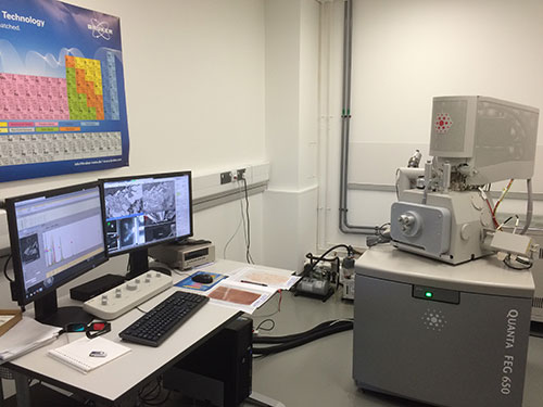
If the 'recce work' identifies any interesting trends or features these are then investigated further using a variety of different methods depending on the required outcome of the analysis. For example, fingerprinting fluid pulses may require zones in a sample to be analysed using a microprobe or laser ablation ICP–MS, whereas the identification of intergrown and similar mineral phases such as those in an amphibole/pyroxene vein may require XRD analysis. This is just scratching the surface of the techniques and methods available to geologists and chemists to allow us to investigate the effect of geological processes on our samples. Mapping the passage of fluids can be achieved using a technique called QEMSCAN, which essentially maps mineral phases and their chemistry; this can be useful to determine where REE minerals are within a sample. Isotope analysis of carbonates can determine their origin and indicate whether they have a 'true' carbonatite source or are the result of hydrothermal processes. For more information on these techniques please visit: http://emps.exeter.ac.uk/csm/facilities/
Data obtained by all these techniques are interpreted to identify trends that can be used in developing geological models. These not only further our academic understanding of igneous complexes and geological processes but also allow us to identify and understand the processes which cause enrichment of critical metals such as REE and Nb. In turn, these models are valuable tools for industrial partners allowing them to more efficiently pinpoint economic deposits. However there is a long road between the world of field work and sample collection, and the end result, that is rarely seen or understood.
Holly Elliott, September 2017
REE deposit road trip, Northern Gobi Rift Zone, Mongolia
Mongolia is a vast country, and one that is richly endowed in natural resources, including copper, coal, gold, uranium and rare–earths. The minerals sector accounted for 17.6% of the GDP in 20141. Most of this contribution is realised through exploitation of coal, copper, fluorspar, molybdenum, silver and cement. Although not currently exploited, there are according to the USGS, 9 known deposits of alkaline– and carbonatite–hosted REEs in Mongolia. Many of these complexes are concentrated in areas along the Northern Gobi Rift Zone (NGRZ) and the South Gobi Fold Belt (SGFB).
In September 2016 Jindřich Kynický led a group of HiTech AlkCarb partners and expert collaborators Dr. Wei Chen (Chinese University of Geosciences), Yondon Majigsuren and Prof. Enkhbat (Mongolian University of Science and technology) on an expedition to the NGRZ to study some of the carbonatite and alkaline complexes within this natural laboratory. Key targets for the group on this 10–day, 1500 km off–road adventure into the heart of the Gobi Desert included Khotgor, Bayan Koshu, Mushgai Khudag, Durbent Doritu and Chetzu Teeg. An important point for the HiTech AlkCarb project is that these complexes are exposed at various erosion levels that correlate with the uppermost portions of alkaline and carbonatite systems.
The expedition began by stocking our trucks with water, dried food, camping equipment, several kilos of banknotes, and then a 550 km journey from Ulanbataar to the NGRZ. The first geological stop was Khotgor, a syenitic and alkali granitic intrusive centre, complete with its own shaman shrine and ancient petroglyphs. It is the largest known REE deposit in Mongolia, enriched in both silica and heavy REEs. The complex has experienced Na metasomatism, which induced extensive remobilisation of REEs, and generated an extensive set of fluorite–carbonate veins.
The next complex, Bayan Khoshu, was eroded further into the alkaline system, revealing late Jurassic – early Cretaceous monazite and syenite plutons, together with trachytic dykes and lava flows. Friable, mica–rich fenites formed here adjacent to multiple stages of carbonatite intrusions. REE mineralization at Bayan Khoshu is hosted within monazite associated with a late stage silicification event.
Mushgai Khudag, the most extensive and best exposed of the complexes we visited, is the second largest REE deposit in Mongolia. There we examined altered nelsonite (apatite + magnetite) within the uppermost parts of the intrusive system, and heavily fluoritized and brecciated country rock. Previous exploration work has showed that the apatite and fluorite are the primary hosts of the REE mineralization, containing up to 17 wt. % REO.
Minimal levels of erosion at both Durbent Doritu and Chetzu Teeg reveal extrusive volcanic rocks. Lava, pyroclastic sequences and epiclastics such as large debris flows are well exposed in these locations. The underlying magma chamber at Durbent Doritu is very much a mystery, therefore it is hoped that geochemical analysis of xenoliths collected from the lava flows will determine whether any REE enrichment has occurred. At Chetzu Teeg the ring structure of this volcanic complex is still clearly visible, intruded into granites of Permian age, making this a good example of a young magmatic system exploiting the pathways created by older magmatic activity.
This exciting mixture of sites allowed us to investigate the alkaline systems at a variety of depths, helping us to visualize and understand their 3D characteristics and patterns of REE mineralization. Study of these complexes and samples collected will generate much data and theories that, in years 3 and 4 of the project, will feed into new geomodels for REE mineralizing systems in alkaline and carbonatite rocks.
The expedition was a brilliant adventure in addition to a spectacular insight in to the Mongolian magmatic systems, a truly epic experience. The team camped each night under the stars without any sources of water, therefore wet wipe showers were a must. Evenings were spent digging up and burning dung in camp fires, learning traditional Mongolian songs and discussing our ideas about the geological sites we visited during the day.
In addition to first class geology (many thanks to Jindřich), the memories of Mongolia will also be of adventure and the warm welcome and much appreciated logistical support of our Mongolian collaborators. A second team from HiTech AlkCarb will visit further alkaline and carbonatite complexes in September 2017 to collect additional field observations and samples that will be used to address key science questions and in the construction of the geomodels. We wish them luck on their adventure!
Holly Elliott and Sam Weatherley
1Xun, S. 2017. The Mineral Industries of Mongolia, In: 2014 Minerals Yearbook, Mongolia, USGS. Accessed 20/July/2017.
Fieldwork in the NW Scottish Highlands and Expert Council Three in Edinburgh
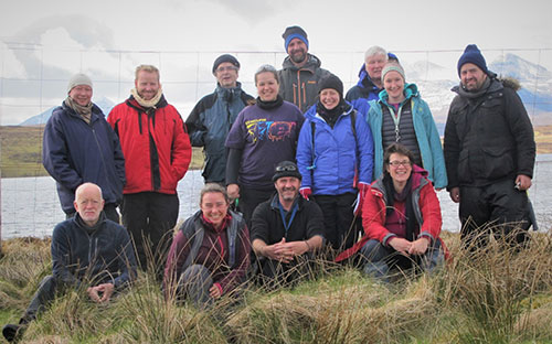
The fantastic scenery of the Scottish Highlands is undoubtedly the best place to observe the large–scale geological processes that shaped Britain during and after the Caledonian Orogeny (Cambrian to Devonian). Eleven intrepid HiTech AlkCarb members and three expert councillors (Gus Gunn, BGS; Ian Parsons, University of Edinburgh; and Anatoly Zaitsev, St Petersburg State University), set out from Edinburgh in April to visit key localities for Scottish alkaline intrusive rocks.
Hosted by Kathryn Goodenough, Eimear Deady and Gus Gunn of the British Geological Survey, the aim of this fieldtrip was to investigate the possibility that the Loch Borralan Complex could be used as a plutonic analogue for volcanism observed during Expert Council One, in the Italian Apennines. Braving horizontal snow and high winds, the group visited a classic Moine Thrust locality at Knockan Crag. Walking up through the stratigraphy, Kathryn delivered a tectonic overview allowing everyone to orient themselves in the geological setting. Following a teashop stop and narrowly missing a ferocious hail storm, the team headed to Ledmore marble quarry, where pseudoleucite syenite and nepheline syenite bodies (the so–called 'borolanite') intruded dolostone. The resulting metasomatic reactions and breccia bodies were spectacular! Many samples and one broken rucksack later, the team went in search of (and eventually found) Alan Woolley's fabled REE–enriched fenites within pseudoleucite syenites in a small waterfall described in his 1972 paper.
Well–rested and well–fed, the following day involved visiting the disused Allt a'Mhuilinn Quarry – the 'borolanite' type locality, before heading along a forestry track in search of 1980's excavations showing pyroxenite and nepheline syenite intruding quartzites. On the shores of Loch Urigill, the team visited the UK's only carbonatite, associated with the intrusion of the Loch Borralan pluton.
On route to the Loch Loyal Complex, the group engaged in some geo–tourism, visiting an Archaean layered mafic intrusion at Scourie More and the infamous Laxford Bridge road cutting. Arriving at Cnoc nan Cuilean on the shores of Loch Loyal, the team set to work finding the REE and Th enriched hydrothermal veins cutting syenites described by Hughes et al., 2013. Although the main exposure had collapsed into the waterfall, smaller veins and brilliant magma mingling textures were observed within the syenites and melasyenites.
Returning to Edinburgh, via the Edradour whiskey distillery, the fieldtrip gang were joined by consortium partners for a two–day Expert Council workshop at the Surgeons Hall. Experts in the fields of roof zone volatiles in carbonatites and alkaline rocks, in addition to sustainable mining were invited to present. Day one focused on roof zone volatiles, with overviews of current research being undertaken at two of our natural laboratories – Greenland, presented by postdoctoral researcher Will Hutchinson, and Kaiserstuhl, Germany delivered by postdoc Ben Walters. Our geophysical partner, Terratec Geoservices, delivered their latest update on the geophysical interpretation of surveys conducted at Kaiserstuhl during late 2016. The second day addressed the 'advancing sustainability' work package and saw several round table discussions. These pertained to the potential issues of mining carbonatites and alkaline complexes, and the information that can be provided by geologists to further sustainable development of potentially exploitable deposits.
Completing a fantastic week, a final bank holiday geologising day was spent at the well–exposed Elie Ness diatreme on the East Fife coastline. Here the remaining few sought the 'Elie Rubies', aka garnets within mantle xenoliths hosted in the diatreme fill.
Holly Elliott and Eimear Deady, May 2017
Airborne geophysical survey of the Kaiserstuhl complex and project presentation by
The airborne magnetic and radiometric survey of the Kaiserstuhl Complex, one of the main natural labs for HiTech AlkCarb, has been completed by terratec geophysical services. 3600 line kilometres were flown and processing of the data is underway. Terratec would like to thank the team for the great work done and special thanks to Kai Naujokat from HTC Germany for flying this difficult survey.
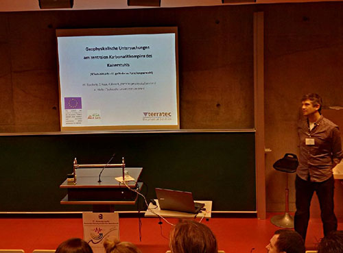
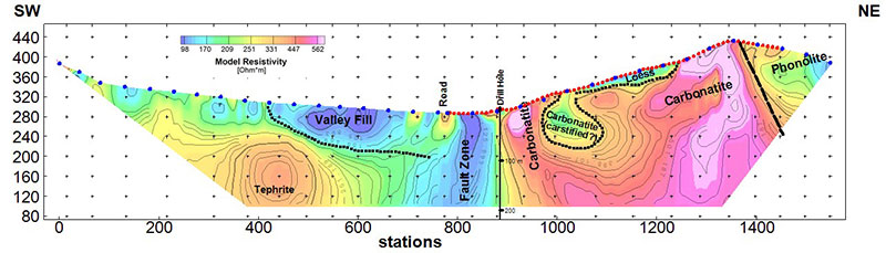
In March 2017 Michael Tauchnitz (terratec) gave a talk with the title "Geophysical Investigation at the Central Carbonatite Complex Kaiserstuhl" at the German Geophysical Society (DGG) conference in Potsdam. The HiTech AlkCarb project, the test site of the central carbonatite complex in the Kaiserstuhl, the geophysical methods applied, and the preliminary results obtained were presented to the audience. The focus of the presentation was the joint data processing and 3D modelling/inversion of the high resolution near-surface and deep (approx. 300 m) Resistivity and Induced Polarization (IP) measurements. As a preliminary result, the interpreted model resistivity depth section of line_4 showing a good correlation to the known geology was shown and discussed.
Expert Council Two – Malawi – Fenite and Geophysics as Exploration Tools

The Chilwa Province, Malawi is famous for its early Cretaceous carbonatitic and alkaline volcanism in addition to excellent exposure of fenites (metasomatically altered rocks), providing a perfect destination for another HiTech AlkCarb Expert Council. Project partners from Mkango Resources Ltd, Alex Lemon and Will Dawes, teamed up with SoS RARE partner, Sam Broom–Fendley (Camborne School of Mines) to lead 50 expert geoscientists on fieldwork to six volcanic complexes. This was the largest geological research conference ever held in Malawi.
Lying at the southern end of the East African Rift, the Chilwa Alkaline Province displays a range of rocks including carbonatites, nepheline syenites and peralkaline granites in a Precambrian gneiss and granulite basement. The igneous complexes have been shallowly eroded, exposing intrusions and breccia above the magma chamber. Therefore the only way to understand deeper processes is to analyse surface exposures of intrusions and fenites or to use geophysical techniques.
After many attendees had journeyed over 48 hours, they showed their commitment listening to the first seminar session. Dr Alan Woolley, a world renowned carbonatite specialist, opened the talks introducing the geology of Malawi, followed by Sam Broom–Fendley acquainting us with Songwe Hill and Will Dawes (Mkango) providing an exploration company's perspective on Malawi prospects.
The first site was Songwe Hill, the flagship deposit of Mkango Resources, visiting trenches which revealed an outcrop of synchysite–rich carbonatite named 'the tip of the iceberg' by the Mkango team. Fenite breccias and late stage REE rich carbonatite intrusions were also viewed on site followed by a rare opportunity to view Songwe halved drill core.
Although evenings were filled with seminar sessions, one day was spent at the hotel for talks regarding the workshop subject – geophysics and fenites. Pete Siegfried opened talks by discussing how geophysical techniques play a role in the search for and understanding of alkaline complexes. After lunch, the fenite session convened with talks from specialists such as Sven Dahlgren, who has conducted significant research on Fen, Norway – the fenite type site.
Our break from fieldwork was followed by a visit to Kangankunde. Upon arrival geologists reverted to kids, hammering boulders of monazite–bearing carbonatite to find shiny green monazite crystals. That afternoon, the team were privileged to visit the core shed of Mota–Engil and spent happy hours inspecting Tundulu breccias and intrusions. The phosphate mine at Tundulu was visited the next day, where an Optichem employee showed the group where apatite rich carbonatites were mined for fertilizer.
After the last field day, visiting Nkalonje's fenite breccias and carbonatite intrusions, the workshop attendees dressed up in their glad rags to attend the gala dinner. Starting off formally with speeches from Prof Frances Wall, Alex Lemon and the Honourable Bright Msaka SC (Minister for Natural Resources, Energy and Mining), the night ended with dancing along to Malawian music celebrity Lucius Banda.
Whilst the majority of the workshop delegation flew home on day 8, a small hard–core group of geologists remained on for a 10 day fenite sampling mission. After a much needed afternoon off hippo, elephant and crocodile spotting on the Shire River, the team re-visited and sampled each complex. Data produced from the 190 kg collected, will be fed into a HiTech AlkCarb geomodel of alkaline and carbonatite systems. Read a longer account of the trip.
Holly Elliott, November 2016
Greenland fieldwork July–August 2016
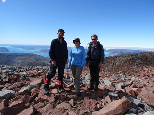
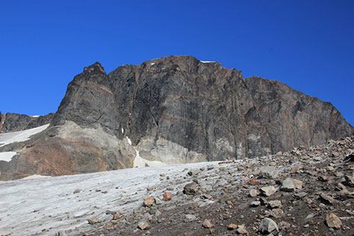
In July and August 2016 members of the HiTech AlkCarb project team (from the University of St Andrews) visited the Gardar Province in South Greenland. The Gardar is an ancient rift zone that was volcanically and tectonically active between 1300 and 1100 million years ago. Although the province is no longer active, it is of major interest to geologists because the subsequent uplift and glacial erosion have cut deep into the rift and exposed the rocks and magma chambers that once lay well below the surface.
Magma that stalled at upper crustal levels in the Gardar rift evolved to very extreme compositions. This generated high concentrations of incompatible elements, including uranium, thorium, niobium and tantalum, in the tops of these magma chambers. As a result the Gardar Province hosts some of the world's best mineralised magma bodies and our field work aimed to identify the roof zones of these alkaline complexes and understand more about the processes that concentrate the so–called 'rare–earth elements' (REE).
Our focus was the roof zones of the alkaline complexes Ilímaussaq and Motzfeldt. These complexes are only 50 km apart, host significant REE resources and yet their composition and magmatic evolution appears to be quite different. By comparing and contrasting these two unique complexes we wanted to understand whether or not the same underlying processes were taking place.
We were fortunate to have 5 weeks of glorious weather and this allowed spectacular views of the intrusions and detailed sampling surveys to be undertaken. We also had breathtaking views of the fjords, glaciers and mountain ranges of South Greenland. Intriguingly, despite the compositional differences between the Ilímaussaq and Motzfeldt complexes, we found that the magmatic processes taking place in the roof zones were very similar. In both cases we were able to identify sinuous alkaline dykes and sheets penetrating the country rock, and comparable chemical alteration textures were visible around the margins of each intrusion. We collected a range of geological samples and our next objective is to characterise rigorously their mineralogy and alteration using petrographic and microanalytical geochemical tools. We will develop a set of geochemical indicators for alkaline roof zones and use these new tools to evaluate other complexes in Europe (e.g., Kaiserstuhl, Germany) and understand whether or not these prospects might offer comparable REE resources to those in the Gardar.
HiTech AlkCarb – Expert Council One – Italy
June 15th saw the first expert council meeting of the HiTech AlkCarb team and associated expert council members. Attendees travelled from around the world to Italy to examine some examples of volcanic carbonatites and alkaline rocks, whilst being treated to Italian culture and food. The first expert council was convened to review the first five months work on the EU funded project and to focus on questions relating volcanic expressions of carbonatitic and alkaline rocks to the processes operating at depth.
Why Italy?
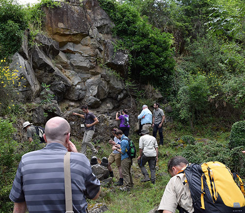
The Università degli Studi "G. d'Annunzio" Chieti–Pescara team are leading the research linking volcanic rocks to economic mineral–forming processes within the crust. The meeting aimed to bring the group together to see some examples of Italian carbonatites and alkaline rocks. We had two days in the field examining a phosphate–rich deposit that overlies a carbonatite, where a herd of cows seemed as interested in the rocks as we were. On day two of fieldwork we visited the volcanic complex at San Venanzo, and the diatremeic volcano at Polino. The fieldwork was complemented with plentiful, delicious Italian feasts and on the third day we arrived in Chieti ready for some serious discussions.
The village of Torrevecchia Teatina just outside the city of Chieti was the location for our presentation and discussion sessions. The morning session consisted of talks by team members on their research so far. The invited expert councilors (Marie Edmonds, Jock Harmer, Stefano Salvi, Tony Mariano Snr and Tony Marino Jnr) gave presentations on related aspects of the science or exploration as it currently stands. The afternoon was spent on 'sand–pit' discussions, which aimed to get us out of our comfort zones discussing a range of topics, with a range of different people from the group.
The fantastic trip was organized by Prof. Francesco Stoppa, Dr. Gianluigi Rosatelli and Dr. Andrea Tranquilli who brought together a mixture of geology, food and culture, leaving us all with very fond memories of Italy and stimulated to get back to the labs to continue our research.
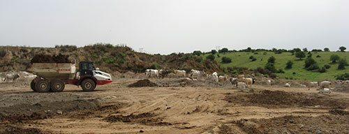

Ground geophysics under way at Kaiserstuhl
Terratec have started the ground geophysical work at the Badberg location in the Kaiserstuhl, with two Electrical Resistivity Profiles looking down to approx.100 m. The data are very good quality, and promise well for the deeper investigations planned to start on the 25th of July. The terratec team was accompanied in the field by Björn Heincke from GEUS. As an outcome of this field work and the discussions we had, we will fine tune the future profiles and methodologies for ground geophysics. The airborne geophysical work is also under preparation.
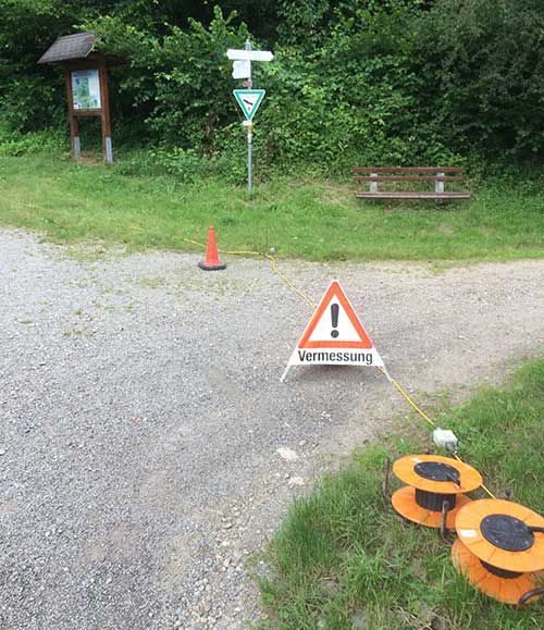
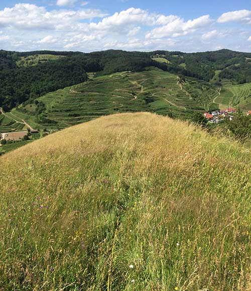
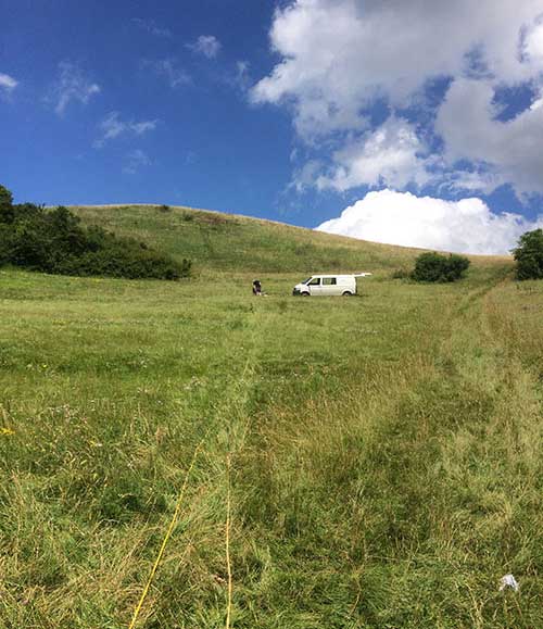
First meeting with the mayor of the Vogtsburg Gemeinde and heads of councils to introduce the anticipated scientific programme at the Kaiserstuhl alkaline-carbonatite volcano, Germany
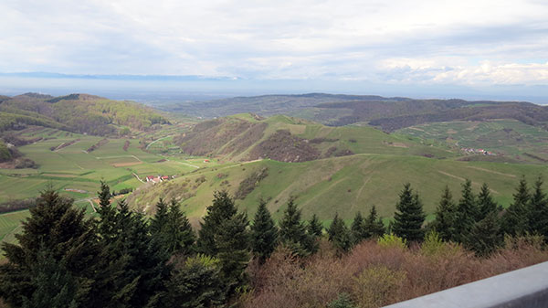
On 13 April 2016 the HiTech AlkCarb project team held a first meeting with the mayor and heads of local councils in Oberbergen at the Kaiserstuhl, Germany. During the meeting, partners of the project (from the University of Tübingen, terratec Geophysical Services GmbH & Co. KG, and A. Speiser Environmental Consultants) introduced the scientific programme and explained why we would like to work at the Kaiserstuhl.
The Kaiserstuhl alkaline-carbonatite volcano is an ideal project area in which to gain in-depth knowledge about how rare earth elements and other critical metals have become enriched in some volcanic rocks during the active volcanic phase. Over the past centuries plenty of scientific work has already been conducted, but now new and more advanced geophysical methods have been developed that will allow us to acquire more details during the project. This information will be used to meet the overall goal of developing new geo-models for international critical metal exploration programmes.
The initial fieldwork entails taking rock samples with a hammer from existing rock exposures and old quarries. Additionally, geophysical surveys will be conducted along tracks. The main focus of these activities will be at the centre of the Kaiserstuhl (Badberg and Ohrberg). This will be followed by an airborne survey during which magnetic and radiometric data will be collected using a helicopter. The area which will be investigated is approximately 12 x 12 km.
Finally, it is anticipated that a borehole will be drilled to obtain a continuous core of rock down to a depth of a few hundred metres. The final location can only be decided once the ground geophysical and airborne data have been analysed. The core will provide samples that we can analyse to study the enrichment of rare earth elements and other critical metals in the rocks at depth.
The mayor and heads of councils are very interested in this scientific research project. However, work can and will commence only once all necessary authorisation documents and permits have been obtained from the local government institutions. The mayor raised concerns following on from previous drilling in the area. Previously, in the village of Staufen, anhydrite layers started to expand after water leaked into that stratigraphic layer during and after drilling, resulting in damage to houses in the area. In Basel hydro-thermal drilling, where water was pumped into the borehole, resulted in some small earthquakes. We explained that the geology at the Kaiserstuhl is totally different to that in Staufen and Basel and that such issues should not occur at the Kaiserstuhl. Furthermore, we are only drilling to obtain a drill core and after further downhole measurements the hole will be sealed off. The University of Tübingen offered to provide a written statement stating that none of the above raised concerns will happen at the Kaiserstuhl. We mentioned that the only problem occurring during the drilling could be that we hit water. If so, we will take care of that and ensure that the borehole is sealed off correctly. Finally, the mayor asked us to provide him with proof of liability from the drilling company and with a long-term liability, which will be arranged by our project team.
To inform the wider public of the Kaiserstuhl area, the mayor suggested that we write a short notice for the local municipality newspaper in which we explain the project. This has been done and was placed in the edition of 22 April 2016.
Subsequently, the documents for the permit to conduct the initial geological fieldwork and geophysical surveys were submitted to the 'Landesbergdirektion' (relevant authority to grant such permits). On 27 April we received an answer that we can go ahead, as no permission needs to be granted in regard to the existing legislation, because the project is only for scientific work. Our geological research at the Kaiserstuhl will get underway in early summer 2016.
Alexandra Speiser 5 May 2016
HiTech AlkCarb kick–off meeting 22–23 Feb 2016 | Mission for Improved Mineral Exploration Underway!
The HiTech AlkCarb project kicked off in London, 22-23 February 2016, at the Natural History Museum. 29 participants attended the meeting, representing each of the 12 project partners. Special guest Michael Le Bas was also present, to guide and encourage improvements from his 1977 model, still considered the standard in understanding carbonatite complexes (see below).
 based on observations in Kenya. HiTech AlkCarb aims to revise and develop this model, and to link in areas of mineralisation.")
The project will:
- Develop new geomodels to explore for 'hi-tech' raw associated with alkaline rocks and carbonatites, including exploration indicators to target mineralisation at depths to 1 km.
- Improve and develop of geophysical and downhole exploration techniques.
- Transfer into Europe expertise gained in African exploration.
- Give Europe world-leading expertise in critical raw material exploration.
Day One was a project overview, with presentations from Frances Wall, the European Commission Officer, and work package leaders: Kathryn Goodenough (British Geological Survey), Pete Siegfried (Geo-Africa Prospecting Services), Klaus Brauch (Terratec Geophysical Services), and Alexandra Speiser (A. Speiser-Environmental Consultants). Plans for fieldwork this year in Greenland and Mongolia were discussed, as well as the first two Expert Council meetings, one in Italy in June 2016, and the second in Malawi in October.
The theme of Day Two was 'The Science' and started off with a review by Alan Woolley based on his series 'Alkaline Rocks and Carbonatites of the World', the most comprehensive catalogue available.
Presentations
Presentations and discussion then followed six key geological questions:
- How can we predict what intrusive rocks are present at depth by using volcanic carbonatites and alkaline rocks exposed at the surface?
Michael Marks and Gregor Markl - How can we relate mineralisation in shallow volcanic and sub-volcanic carbonatite and alkaline systems to predict richer deposits at depth?
Gianluigi Rosatelli - How can we better understand the plumbing systems down to 1–2 km (the most important environment for mineralisation)?
Jindŕich Kynický - Can we use the geochemistry and mineralogy of fenite (alteration around carbonatites and alkaline rocks) as an exploration indicator?
Frances Wall and Holly Elliott - How can volatile elements in the roof zones of alkaline complexes (F, Cl, OH, S) be used to indicate if there is a prospective deposit below?
Adrian Finch - Is the unusual element enrichment in scandium in carbonatites found at Glenover, RSA a potential economic resource?
Pete Siegfried
The final presentation focused on the scientific research site in Germany. By acquiring new geophysical in combination with surface geological data, it will be the most detailed study ever of a carbonatite-alkaline complex.

Dylan McFarlane 2 March 2016